Guilin is a small town (as far as China is concerned) in Guangxi Province, whose main claim to fame is it is one of the most spectacular examples of karst topography in the world.

The karst terrain covers over 5,000 square km and has formed by a combination of rapid uplift (courtesy of the collision between the Indian Plate and the southern Eurasian Plate, combined with erosion and dissolution of the carbonate deposits that covered the area. The result is a flat plain, interspersed with steep sided peaks that often exceed 50 m in height, which occur individually or in small clusters.


The flat plains are intensely farmed or developed. The hills are too steep for development, but often have temples or pagodas at the top.


These peaks have been of great cultural significance for hundreds, perhaps thousands of years. Apart from the temples built at the peak, the base (and often various patches some height above the base) of many of these peaks have been decorated with poetic or religious inscriptions, dating back many centuries.


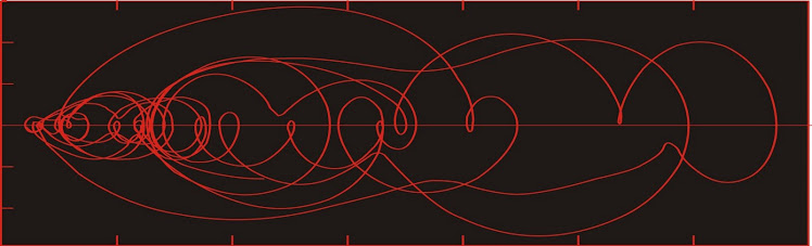
Although there are more than one erosional mechanism active in the formation of karst topography, dissolution of the carbonate rock is critical. Both surface and ground waters quickly become saturated with carbonate, normally causing some dissolution and an uneven surface. Carbonate rocks are somewhat permeable, meaning water flows through them quite easily. When two different masses of water meet, even if both are saturated in carbonate, the resulting mixture is always undersaturated, leading to dissolution at the water table, where meteoric water encounters groundwater.

Diagram showing that corrosion (dissolution) occurs at the surface, at the water table, and at interfaces between different bodies of groundwater. From Scholle, et al. (1989).
Corrosion begins in the mixing zones between bodies of water with differing chemistry, and is most intense along pre-existing lines or zones of weakness. Zones of weakness can include both fractures and bedding planes. When this dissolution begins, it is commonly influenced by regional stress fields.

Carbonate "pavement" near Marmora, Ontario, showing dissolution along lineaments related to the local tectonic stress field.
As dissolution proceeds, the caves and crevasses tend to get larger. Random areas within the carbonate will be more resistant to dissolution, possibly due to chemical variability, but also because if fractures are more or less randomly distributed, there will be some large areas with relatively few fractures. These resistant regions end up as the remnants of undissolved rock that end up as the peaks around Guilin.

Since dissolution is such an important factor in the formation of this landscape, we will see a variety of local features in rocks of the area that reflect dissolution.


Luckily, the Chinese like these sorts of rocks and tend to put them on display everywhere. These examples were in Shan Lake park (site of the twin towers, which were not made of silver and copper after all).

Karst topography viewed from the Li River, south of Guilin.


Viewed from within Guilin, from the peak in the old walled city.
The flat plains are intensely farmed or developed. The hills are too steep for development, but often have temples or pagodas at the top.


Diagram showing that corrosion (dissolution) occurs at the surface, at the water table, and at interfaces between different bodies of groundwater. From Scholle, et al. (1989).
Corrosion begins in the mixing zones between bodies of water with differing chemistry, and is most intense along pre-existing lines or zones of weakness. Zones of weakness can include both fractures and bedding planes. When this dissolution begins, it is commonly influenced by regional stress fields.

Carbonate "pavement" near Marmora, Ontario, showing dissolution along lineaments related to the local tectonic stress field.
As dissolution proceeds, the caves and crevasses tend to get larger. Random areas within the carbonate will be more resistant to dissolution, possibly due to chemical variability, but also because if fractures are more or less randomly distributed, there will be some large areas with relatively few fractures. These resistant regions end up as the remnants of undissolved rock that end up as the peaks around Guilin.

Moon Hill, near Yangshuo.
Since dissolution is such an important factor in the formation of this landscape, we will see a variety of local features in rocks of the area that reflect dissolution.


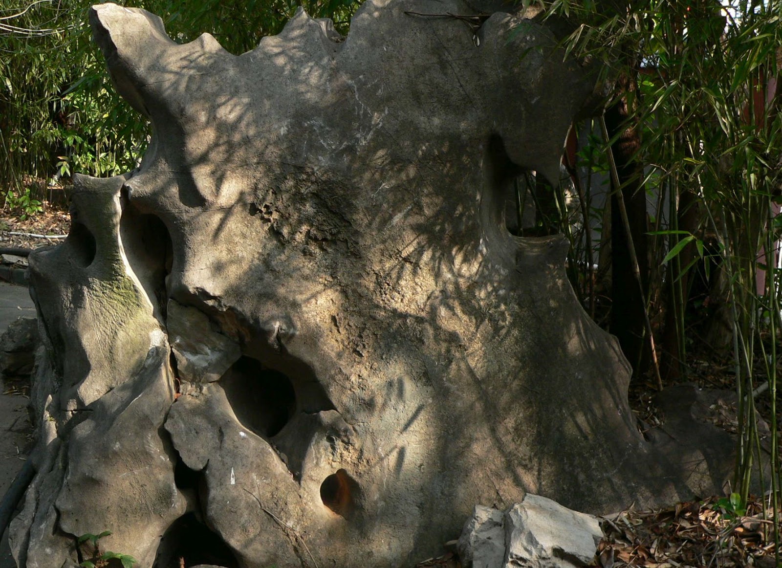
Luckily, the Chinese like these sorts of rocks and tend to put them on display everywhere. These examples were in Shan Lake park (site of the twin towers, which were not made of silver and copper after all).
No comments:
Post a Comment